Drone Surveys and Aerial Photography
At Hyla, located in the heart of Malvern, Worcestershire, we specialize in professional drone surveys and aerial photography. Our team of certified pilots leverage cutting-edge drone technology to deliver stunning visuals and detailed data from unique angles, providing affordable insights that traditional methods might not be able to deliver and data you can rely on. Whether you require aerial images for construction, industrial monitoring, or conservation, Hyla stands ready to elevate your vision.
All of our pilots are fully trained and suitably qualified with flyer ID's, A2 Certificate of Competence (A2CofC), and General Visual Line of Sight Certificates (GVC). We utilise a range of professional enterprise and prosumer camera drones from industry leader DJI, which combined with our Civil Aviation Authority (CAA) PDRA01 Operational Authorisation and experience of gaining permission to operate within flight restriction zones allows us to operate in most areas across the West Midlands, Cotswolds, and beyond.
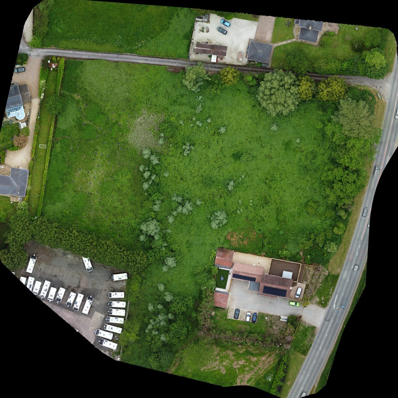
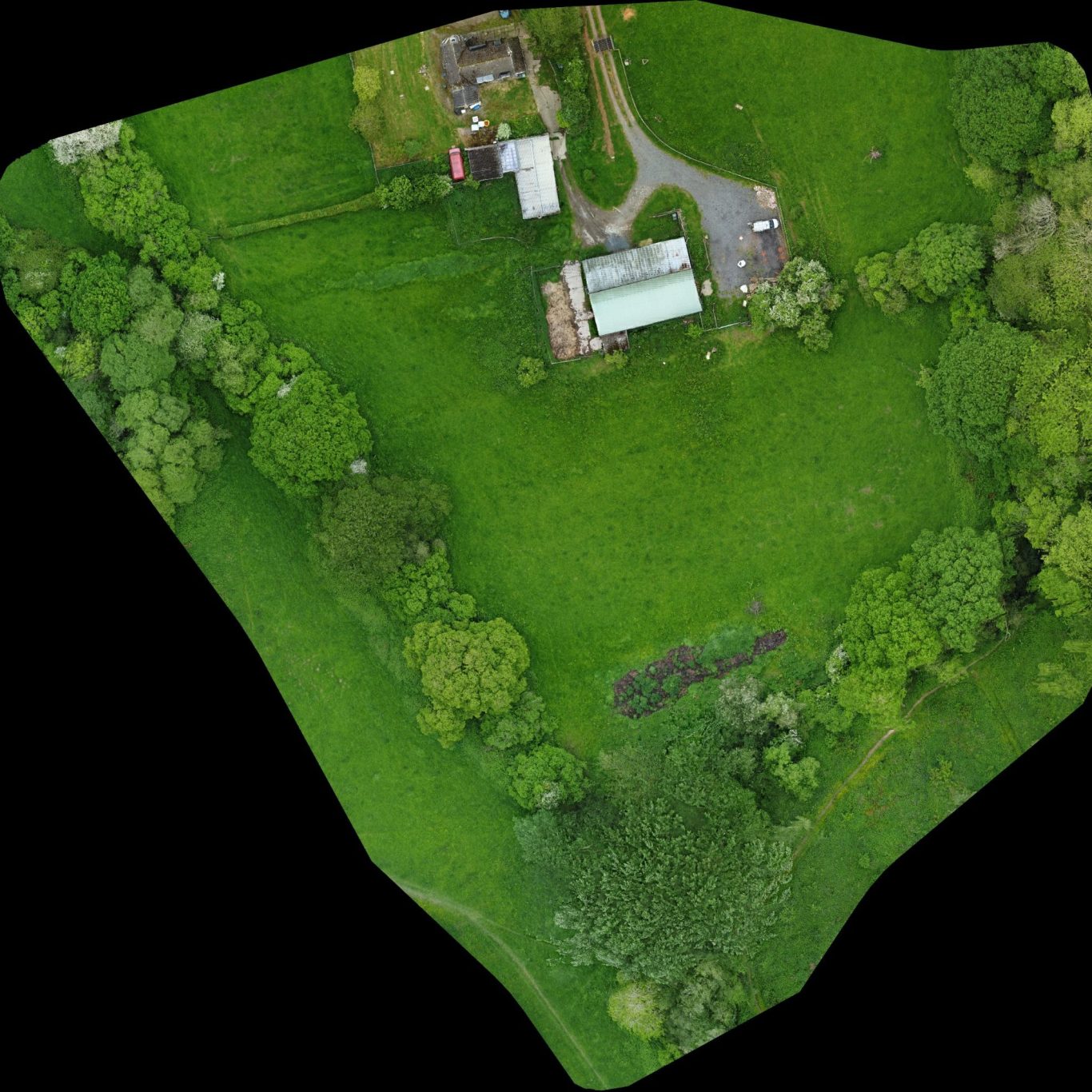
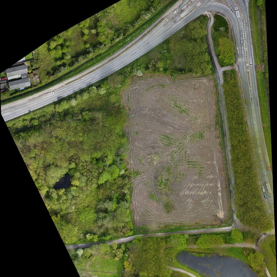
Orphomosaic mapping
At Hyla, we specialise in providing orphomosaic mapping for site survey, development monitoring, and habitat monitoring.
Using DJI enterprise series drones we can capture stunning 48mp visuals of your site and stich them together to form geometrically orthorectified images at much higher resolution than that available from google earth or similar online services.
When loaded into Geographic Information System mapping software such as ArcGIS or QGIS our orthomosaics can be georeferenced and accurately measured.
Do you require orphomosaics of an urban site? No problem, using small prosumer level drones to legally and safely overfly people and property we can still capture 12mp visuals.
Flights can be repeated at regular intervals to monitor changes overtime, ideal for tracking the progress of your projects over weeks, months, or years.
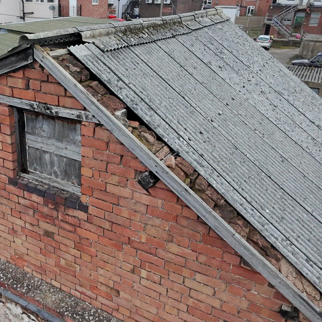
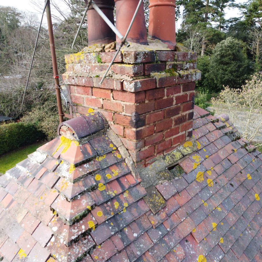
Aerial photography
Our specialists in aerial photography can help you view parts of your property you may not usually see, allowing you or your surveyors or contractors to assess the condition of roofing materials, chimneys, gutters, parapets, and other hard to reach areas.
Whether you're a structural surveyor, roofer, chimney sweep, steeplejack, stonemason, builder, or homeowner we can supply high resolution photographs at 12-48mp or video at up to 4K. We can also stream images direct to a monitor allowing you to view a live output so you can direct us to the areas you want to see.
Drone photography is incredibly cost effective compared to scaffold or Mobile Elevated Work Platform hire and far safer than working at height.
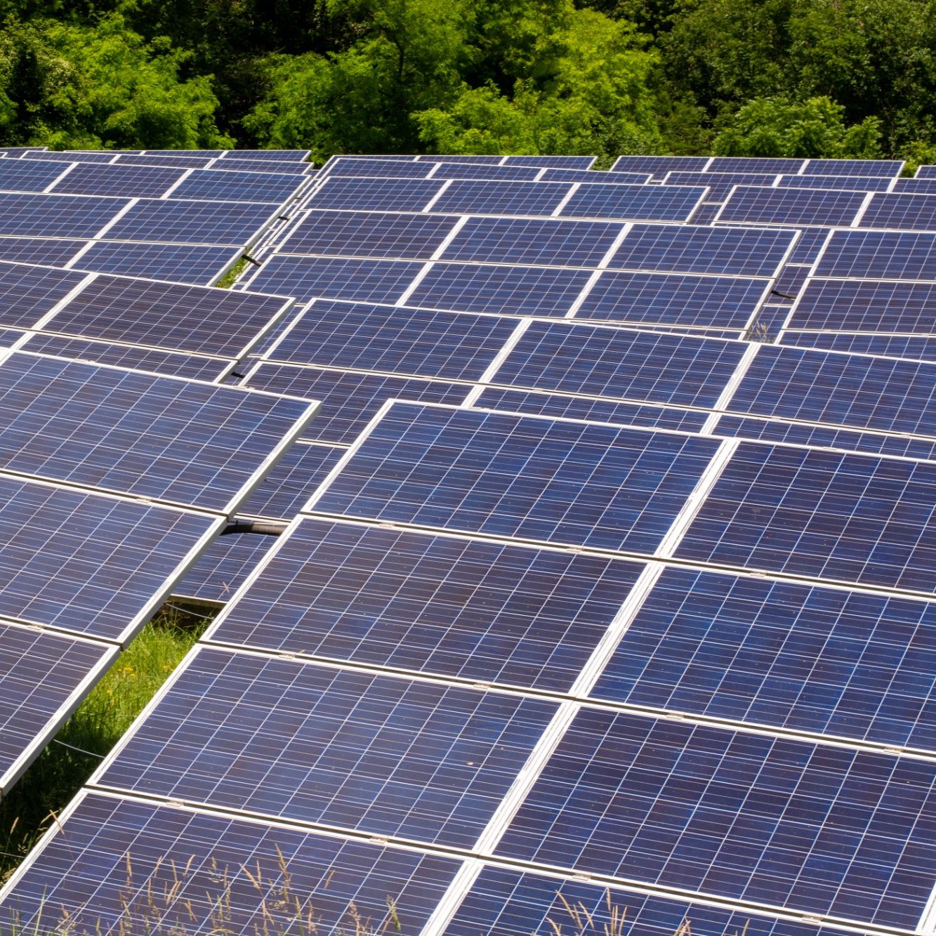
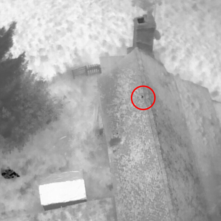
Thermal imaging
In addition to visual photography and videography Hyla can provide thermal imaging, taking inspection services to the next level and helping you identifying issues such as moisture ingress, heat loss, and insulation failures not usually visible to the naked eye.
Using drone mounted Forward-Looking Infra-Red (FLIR) cameras we can take targeted photosets and video of specific features or create orphomosaic maps aiding 3rd party heat-loss assessments and monitoring of photo voltaic (PV) solar arrays.
Thermal drones can cover large areas quickly and safely reducing time and costs and can be easily repeated at regular intervals for ongoing monitoring.
Ecology and conservation
Hyla is a division of ATW Ecology Ltd, specialists in terrestrial and aquatic ecological consultancy we are therefore well placed to provide drone services for environmental and ecological survey, monitoring, and conservation projects.
Regular uses for our drone services include aiding Preliminary Roost Appraisal of complex structures for bats and nesting birds, aerial tree assessment where climbing is considered unsafe, and high resolution orphomosaic mapping for up-to-date UKHab survey and Biodiversity Net Gain assessments including on-going monitoring of Habitat Banks.
Our thermal drones are also perfect for thermal dusk emergence bat surveys of complex buildings, targeting farmland bird surveys, and population monitoring of deer and wild boar.
Get in touch
Hyla Media is a trading name of ATW Ecology Ltd.
E-mail: hello@hyla.media
Address: Malvern, Worcestershire, England